

Municipal Unit of Krionerida
Presentation of the settlements of the Municipal Unit of Krionerida in the context of the “Getting to know the villages of Apokoronas” initiative:
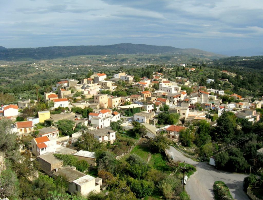
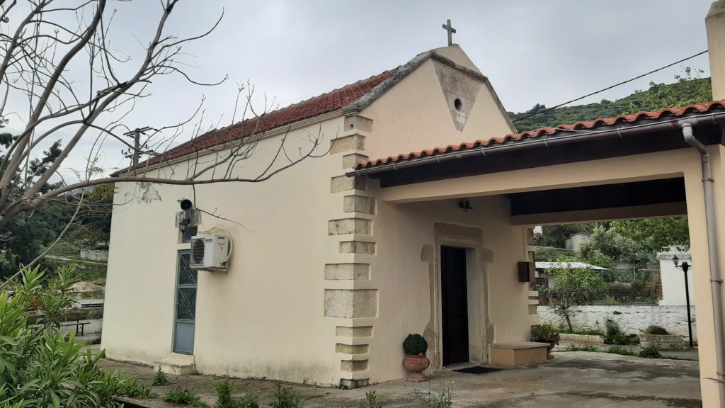
VRYSES
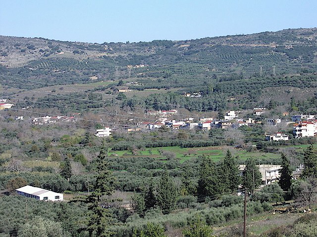
Vrises is the seat of the Municipality of Apokoronas and according to the 2011 census it has 740 inhabitants. The village is located on a slope at an altitude of 70 meters and is crossed by the rivers Vrisiano and Boutakas. The name of the village comes from the existence of many springs in the area which used to be called “vrises”. The village is relatively new, as it did not exist until the beginning of the 20th century, but this location has played an important role in recent Cretan history.
During the revolution of Daskalogiannis in 1770, 12,000 Ottoman soldiers were camped in the area, which the Pashas of Crete gathered to suppress the rebellion. At that time, the inhabitants of Apokoronas could not react to the gathering, but in 1866 the development was very different. Then, Shahin Pasha camped at Vrises with 5,000 Egyptian soldiers, but on 26 August 1866, he was attacked by Christian rebels who set out from Askifou. The Turkish-Cretan Hassan Badris rushed from Chania with 2,000 men to support Shahin Pasha, but their forces did not succeed in repelling the attacks of the Christians. Realizing that he could not hold his ground, Shahin Pasha raised a white flag and showed willingness to capitulate, but at the last moment he fled, leaving behind large quantities of armaments.
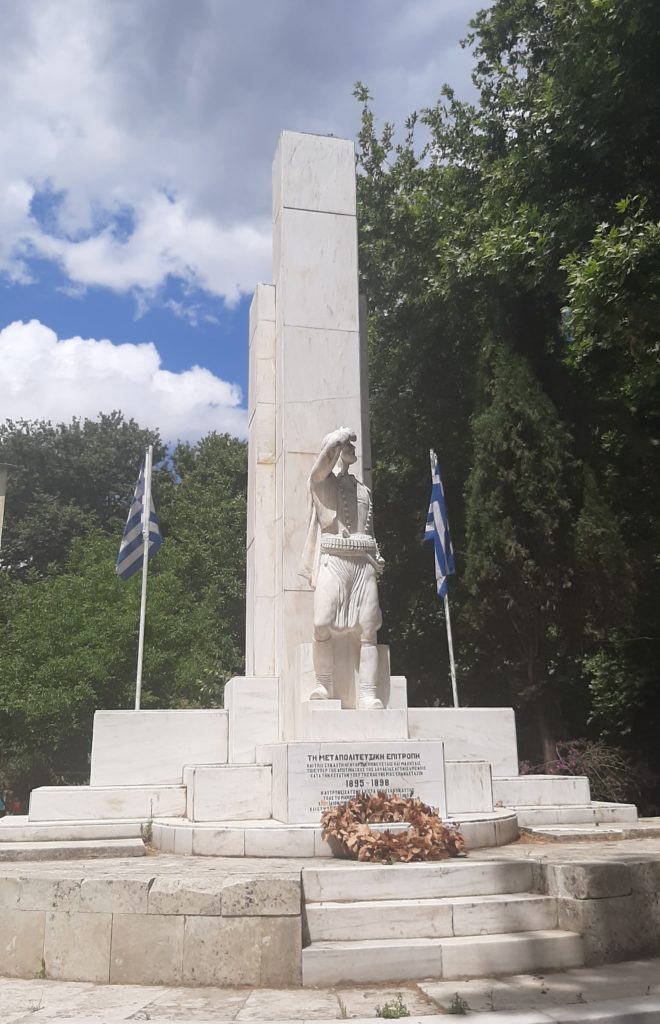
An equally important battle took place in the autumn of 1877 in the nearby location of Kefalovrisi, but even more important was the one that took place in Kefala Vrison (then called Alikampos) on 27 November 1895, shortly after the beginning of the Post-political Revolution in October. During this battle, the Christian rebels successfully repulsed a strong Ottoman force of 3,000 men. According to the description of Prevelakis, “In the then bare and uninhabited position of Vrises and in the hills above, the Post-political Committee won its first brilliant victory. After a fierce battle on 27 November 1895 that lasted throughout the day, the Turks were defeated, leaving 196 dead and wounded out of the battle.” In commemoration of this event, a monument was erected in the village, as well as busts of Iosif Lekanidis and Manousos Koundouros.
According to available sources, the village began to be built during the period of autonomy in 1905 and became an independent community in 1925, but due to its location near the main road of Chania – Rethimno and on the main road to Sfakia, it developed rapidly. In the following years, the settlement experienced significant economic and population growth, but the German occupation (1941-1945) negatively affected its subsequent course. During the final phase of the Battle of Crete in May 1941, British forces retreated to Sfakia through Vrises, a development that prompted the Germans to bombard the village and cause significant damage to its old bridge, which collapsed a few years later. The village and its population began to recover in the 60s due to the development of transport and tourism.
Vrises became the seat of the Municipality of Krionerida in 1999 according to the “Kapodistrias” Program and the seat of the Municipality of Apokoronas in 2010 according to the “Kallikratis” Program. In the village there are schools of all levels (nursery, elementary, junior high school and Vocational High School), a police station, a fire station, a doctor’s office, a veterinary clinic, a post office and an automatic withdrawal machine (ATM) of the National Bank of Greece.


Editing & editing of texts: Giorgos Limantzakis
ALIKAMPOS
Alikampos is located at an altitude of 330 meters in the eastern foothills of the White Mountains, on a slope known as Alikampiotiki madara and it is not known exactly when the village was founded. Its name possibly comes from a combination of the ancient Greek word άλυς (red) with the Latin word campo (field), because there is a lot of red soil on the slope. According to another theory, the first compound comes from the Arabic word ‘ali which means high, so the name means “high plain”. According to a third theory, the village was named after the Ottoman pirate Uluç Ali who destroyed it in 1567. In any case, the village was mentioned as Alicambo by Barozzi in 1577 and with the same name by Castrofilaca (Venetian census) in 1583.
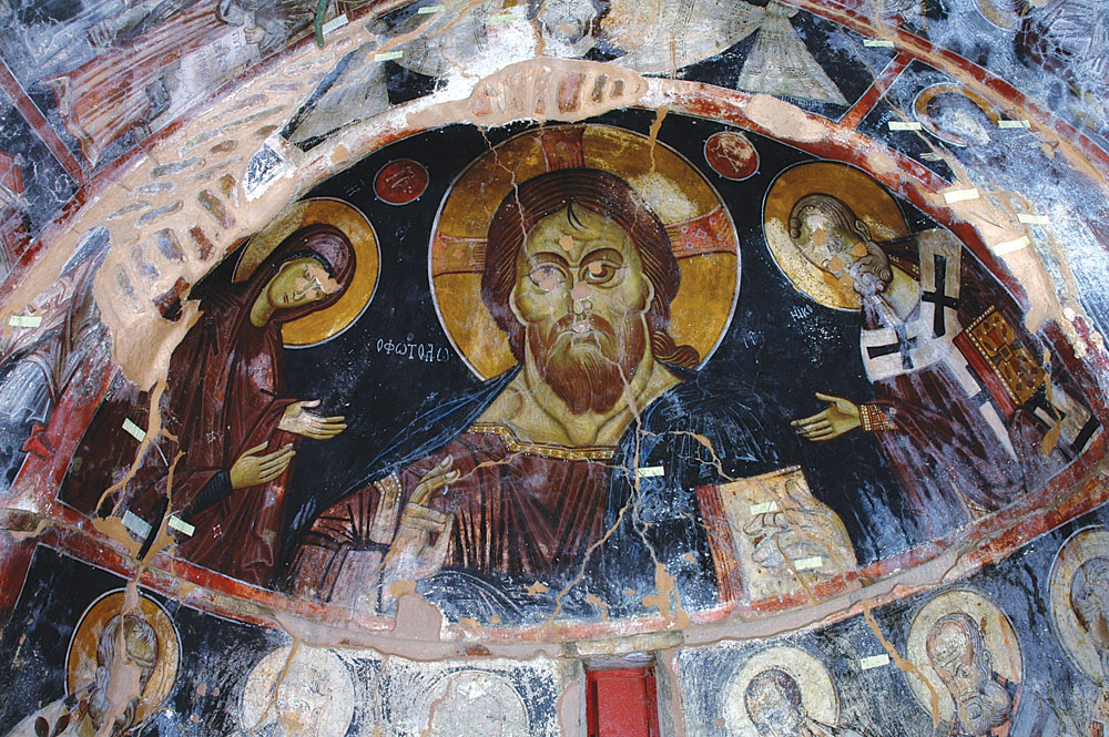
According to available sources, the first to build fortifications in the village were the Arabs, who built a fortress at Pirgioliki in 821 AD. After the reconquest of Crete by Nikephoros Phokas in 961 AD, twelve noble families settled in Crete, and were given large tracts of land. Alikampos was then given to Malavaras, along with an area extending east to Lake Kournas and north to the Vrisiano River. The village flourished during the next two centuries, during which time several churches were built, among which the one of the Dormition of the Virgin, which was frescoed by Ioannis Pagomenos around 1315 and is preserved in good condition to this day.
After the occupation of Crete by the Venetians, the Conti family settled in the village, members of which served as Venetian mercenaries in several wars. However, the locals were dissatisfied with the Venetian government and participated in several revolts against it. They showed particular action during the rebellion of Cantanoleon (1527-1528), as a result of which a force of 3,000 soldiers was sent against them under the general Loukinos Delfermis. Despite the valiant efforts of the inhabitants of Alikampos, the Venetians captured and destroyed the village, while they slaughtered or exiled almost all of its inhabitants. They then tried to sell or settle the village, but the inhabitants of Alikampos managed to return in 1536 and a little later the ownership of their estates was recognized.
The locals’ relations with the Ottomans were no easier than with the Venetians, and Alikampos continued to be a center of revolutionary activity during the Turkish occupation. In March 1824, Tsouderos attacked Hussein Pasha’s Egyptians from Alikampos, but failed to repel them. About seventy years later, on 3 September 1895, the Post-political Revolution started from Klima of Alikampos, when the judge of Vamos, Manousos Koundouros, read before 1,500 armed men a memorandum with the demands of the island’s Christians, while shortly after, Iosif Lekanidis from Alikampos was elected secretary general of the Committee, who played an important role in the conflicts of 1895-1896 and the liberation of Apokoronas from the Ottomans.
Administratively, the village was part of the Municipality of Mathes in 1881, part of the Municipality of Georgioupoli in 1900, an independent community in 1928 and part of the Municipality of Krionerida in 1999, while since 2010 it has been a Municipal Department of the Municipal Unit of Krionerida of the Municipality of Apokoronas.


Editing & editing of texts: Giorgos Limantzakis
VAFES
Vafes is located at an altitude of 210 meters at the foot of the White Mountains, southwest of Vrises. There are many theories about the origin of the name of the village, but the most prevalent one is that it came from a dyer who lived there, which is confirmed by the name of the nearby river called Vammenos. The village was founded in the middle of the 8th century, when the neighboring village of Kourtsa was destroyed by the Arabs and many fled to this location. After the recovery of Crete by Nikephoros Phokas, the Skordilis family settled in Vafes, which remained and was recognized as an aristocratic family even during the Venetian rule. The village was mentioned as Vaffea by Barozzi in 1577, Vaffe by Castrofilaca in 1583 and Vaffes by Basilicata in 1630.
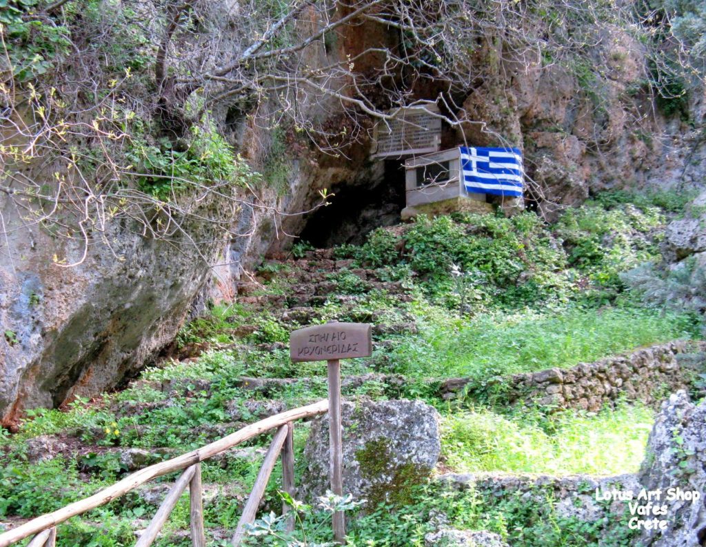
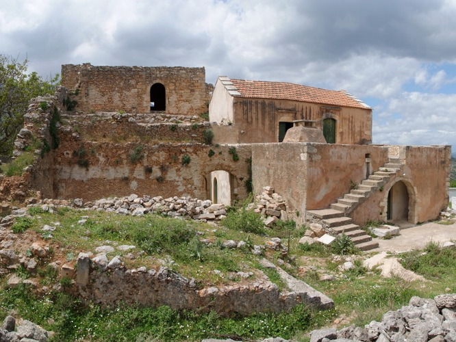
After the occupation of Apokoronas by the Ottomans in 1646, Vafes became the property of a charitable institution which belonged to the mosque of Fidik Hatzi Mehmet Pasha in Heraklion. During the early Turkish rule, impressive buildings were built in the village that the visitor can admire to this day, such as the two-aisled church of Christ, the residence of Priest Emmanuel Skordilis from 1745 and a series of vaulted structures attributed to the janissary Ibrahim Alidakis. Southwest of the village is the cave of Krionerida, which served as a refuge for Christians several times, but was finally discovered by Ottoman soldiers who lit a fire at its entrance on 9 August 1821 and caused the 130 women and children inside it to die of suffocation. The battle of Vafes also took place outside the village on 12 October 1866, when Mustafa Pasha led Ioannis Zimvrakakis into a trap and decimated his forces.
Vafes has been a field of conflict in modern history as well, as on 12 October 1944, the Germans attacked Vafes with strong forces, with the aim of surprising and neutralizing the rebels. This, however, did not succeed, as they were pinned down by heavy fire and suffered significant losses. In commemoration of the above events, a monument has been erected in the center of the village which mentions all the battles in which the locals fought during the 19th and 20th centuries, while in recognition of the village’s heritage, Vafes was declared as a historic protected settlement by Government Gazette 1072/1997.
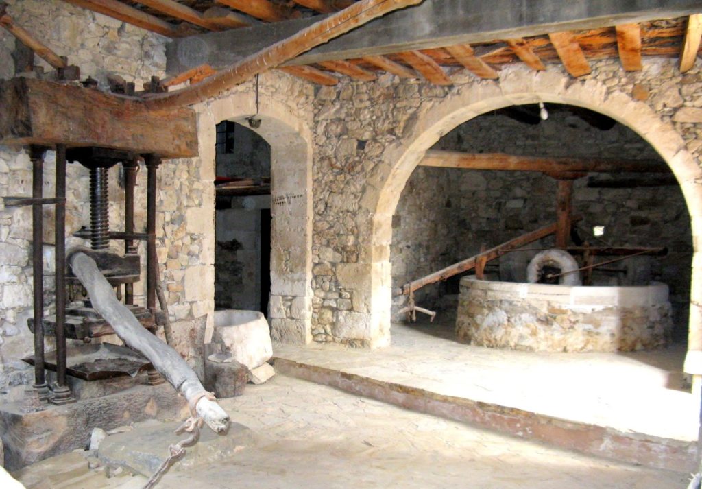
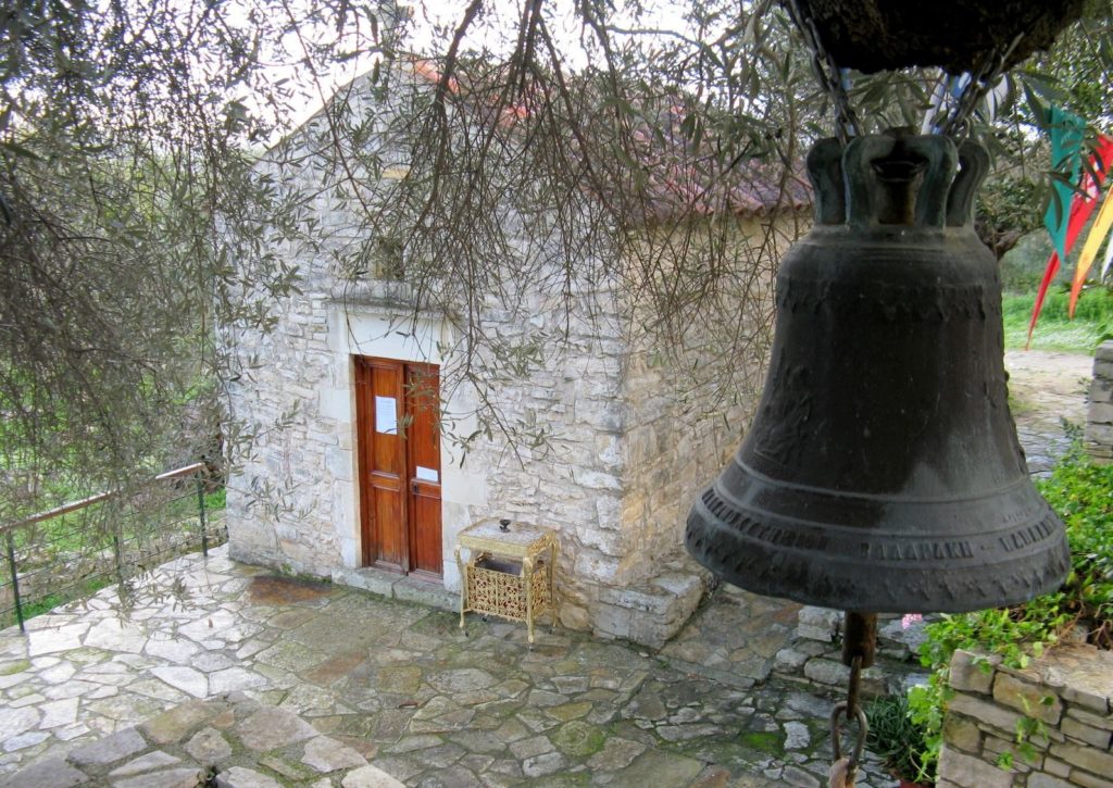
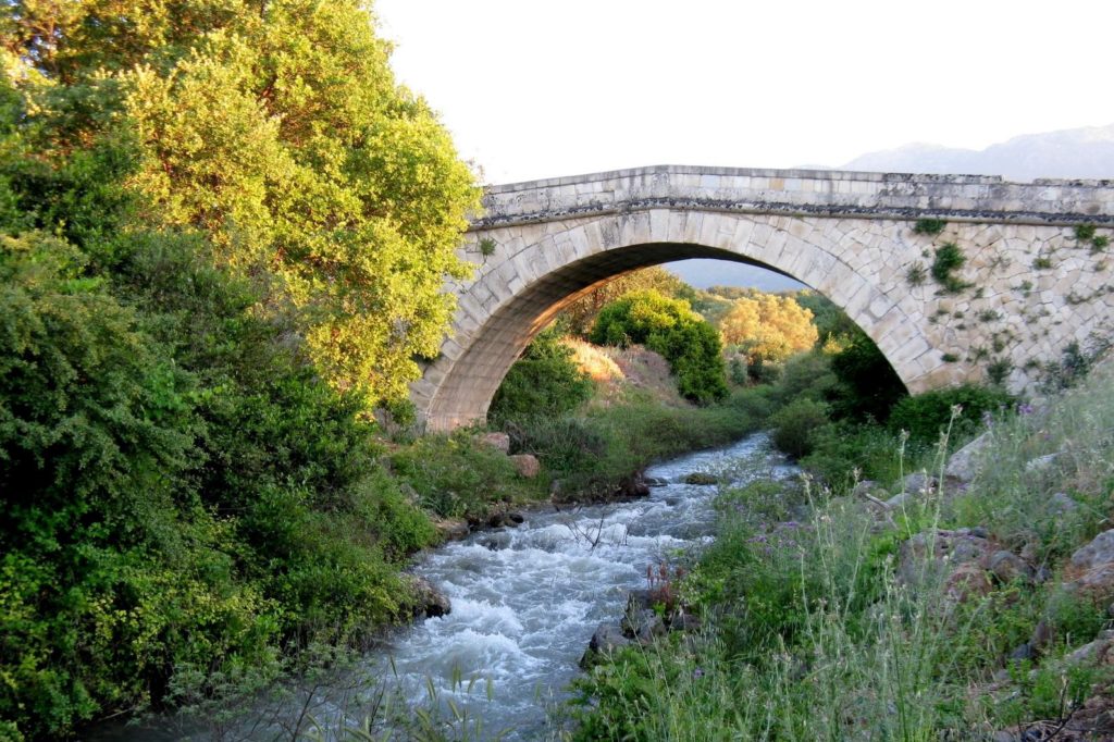
In Vafes visitors can see the old factory (olive press), the 15th-century Church of Agioi Asomatoi and the Boutakas river bridge, while on the slope south of the village is the old settlement of Achatzikia (formerly Achatzikioi metohi), the name of which comes either from the edible archatzikas grass, or from a “haji”, that is, a pilgrim to the Holy Land. Vafes also includes the settlement of Arevitis, which is located at an altitude of 440 meters three kilometers southwest of the village. Administratively, Vafes was part of the Municipality of Fres from 1881 to 1915, when it became an independent community. In 1999 it became part of the Municipality of Krionerida, which joined five other municipalities in 2010 to form the Municipality of Apokoronas.
Editing & editing of texts: Giorgos Limantzakis
EMBROSNEROS
Embrosneros (or Bronieros) is located at an altitude of 241 meters at the foot of the White Mountains, near the borders of the former provinces and now municipalities of Apokoronas and Sfakia. As for the origin of the name of the village, it is said that when one arrives in the village they first encounter the springs. According to another theory, the name of the village is related to the assignment of lands in 963 to soldiers who had participated in the campaign to recapture Crete. These lands were called “pronomies” and their owners “pronoites” or “pronoiates” (progniati during the Venetian period), a name that evolved over time into Pronerites, from where it is estimated that the current name of the village came.
The oldest recorded mention of the village was in 1355 as Brusnero, positi in Oxomorea, “located on the outside”, meaning the northern side of the White Mountains. The village was mentioned as Obrosnero by Barozzi in 1577, Brosnero by Castrofilaca in 1583 and Ombros Nero by Basilicata in 1630. During the first century of Ottoman rule, a detachment of the Ottoman army was stationed in the village, but this did not stop the locals from attacking it. Wanting to get rid of the constant nuisance of these attacks, the Ottoman government assigned the control of the area to the janissary Ibrahim Alidakis, who had his tower in Embrosneros and controlled a large area from the river Mouselas to the heights of Vamos and the White Mountains.
After the inglorious end of the revolution of 1770, Alidakis created his own army in order to gain control of the mountain and the pastures, believing that the inhabitants of Sfakia would not be able to fight back. The latter, however, learned of these preparations and were the first to attack his tower at Embrosneros. After the death of Alidakis in 1774, no potential replacement was found, and as a result, the presence and activity of Muslims in Riza (at the foot of the White Mountains) was significantly limited.
In the village there are several churches (dedicated to Agios Titos, Panagia, Agia Anna, Agia Triada, Agios Nektarios, Agia Aikaterini and Prophet Elias), but also two caves, in one of which the church of Agios Antonios has been built. At Kremastos is the Municipal Theater “Mikis Theodorakis”, which was named in honor of the well-known music composer. The local community of Embrosneros includes the settlement of Vatoudiaris, which is located at an altitude of 350 meters to the south of the village and its name comes from the many bushes that exist in the area. Administratively, the village was mentioned as Brosneros of the Municipality of Mathes in 1881, part of the Municipality of Georgioupoli in 1900 and seat of the homonymous community in 1920, while from 1928 onwards it was mentioned as Embrosneros. The village became part of the Municipality of Krionerida in 1999 which became a Municipal District of the Municipality of Apokoronas in 2010.
Due to the fortified location of the village, in 1822 the “Provisional Administration of Crete” was established in Embrosneros, while the village actively participated in all the liberation struggles that followed. From Embrosneros also came Spiros Vardakis or Vardospiridis, a member of the Post-political Committee that proposed the transfer of the Klima Assembly to Krapi (9 September 1895), where many inhabitants of Sfakia gathered and cooperated. Along with several of his fellow villagers, he fought in the siege of Vamos (May 1896), while after the establishment of the Cretan State, many inhabitants of Embrosneros fought in the Macedonian Struggle (1903-1908), the Balkan Wars (1912-1913) and the Battle of Crete (1941).


Editing & editing of texts: Giorgos Limantzakis
MAZA
Maza is located at an altitude of 160 meters on the heights that extend on the south side of the Vrisiano river. According to tradition, the name of the village goes back to the Byzantine era, when Crete had 100 cities (hence it was known as Ekatopolis) and in this place many people gathered for assemblies, hence Maza (meaning mass). In the central square of the village is the single-chamber vaulted church of Agios Nikolaos, where rare and impressive frescoes by the painter Ioannis Pagomenos dating from 1325 have been preserved. The inscription above the entrance refers to the church as “Agios Nikolaos of Mazianos”, meaning that the village predated the church. In and around the church, tombs of unknown date were discovered during excavation, while a little outside the village is the church of Christ the Savior from the 16th century. The village was mentioned by Barozzi in 1577 as Masa, by Castrofilaca in 1583 as Maxa Filippu Ganbassa (Maza, Filippos and Chambatha) and by Basilicata in 1630 as Masa Alicambo (Alicampos).
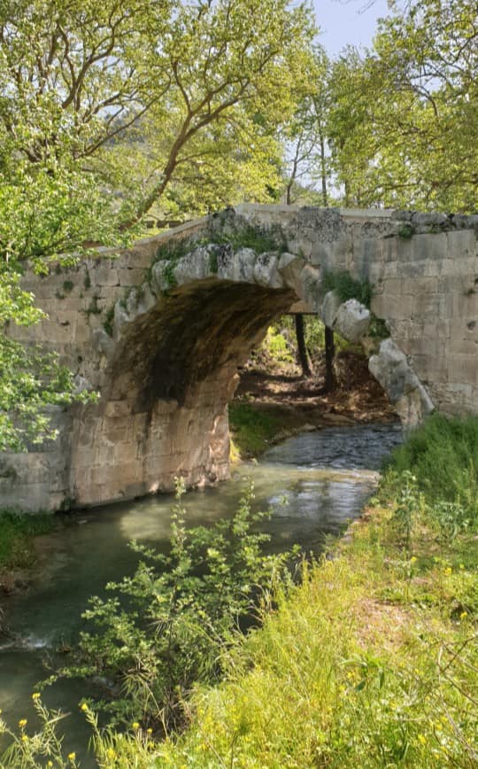
At the end of the 18th century, Maza became a metochi of the janissary Ibrahim Alidakis, who was based in Embrosneros and controlled a large area from the straits of Almiros to Stilos and the peaks of the White Mountains. Alidakis seems to have assembled an army in Maza for patrols or attacks in eastern Apokoronas, and this is why a location near the village was called Agadikos Choros, suggesting that the agades, i.e. the officers of his army, were gathered there. Another notable site is the cave at Voloki or Koudounovoloki, where a Muslim is said to have fled after the battle in Kefalovrisi in 1877 and discovered three sculptures resembling old rulers of the region. On the north side of the village there is a stone vaulted fountain with communal troughs, while even further north is the Greek Kamara, one of the oldest surviving arched bridges in Crete. It was built in the Hellenistic period (323-30 BC), but has undergone later additions. Above it passed the main road connecting Chania with Rethimno, known during the Venetian rule as the “Royal Street” (Strada Reale).
Administratively, Maza was mentioned as part of the Municipality of Mathes in 1881, part of the Municipality of Georgioupoli in 1900 and the seat of the homonymous community after 1925, which also included the settlements of Filippos, Fones and Chambatha. A few months later, Filippos was separated from Maza and annexed to the community of Vrises, while in 1997 the community of Maza became a Municipal District of the Municipality of Krionerida which became part of the Municipality of Apokoronas in 2010.


Editing & editing of texts: Giorgos Limantzakis
NIPPOS
Nippos (or Nipos) is located at an altitude of 175 meters, on a range of hills to the west of the Almiros valley. There are at least three theories as to the origin of the name of the village, but none have been verified. According to Xanthoudidis, the name arose from a sanctuary dedicated to “Hippon and Korin”, from which the word Hippokoronio and the current name of the province, Apokoronas, came. According to another theory, the village was named so because it was located in a plain (napos), a name that was corrupted over time and became Nipos. Finally, according to Troulinos, the village used to be called Rachi and was renamed Nippos by a Venetian official who was sent to the area in 1550 to suppress local resistance.
The oldest reference to the village was in a contract of 1301 of the notary of Khandaka Benv. De Brixano, which referred to the village of Nipo in turma Pisicro (Apokoronas was called Psichro at that time), therefore the third theory is probably not correct. In 1571 the village was burned and completely destroyed by the army of Uluç Ali, but in 1577 it was mentioned by Barozzi as Nippo, in 1583 by Castrofilaca as Nipo or Nippo and in 1630 by Basilicata as Nipo. The village was mentioned again in the Egyptian census of 1834, when it was inhabited by 70 Christian and 4 Muslim families.
During the Cretan revolutions of the 19th century, the village became a gathering place for revolutionaries several times, while the siege of Vamos was decided here on 3 May 1896, a leading event of the Post-political Revolution (1895-1896). The monument in the center of the village is a small tribute to some of the most prominent men of the village, such as Theoklis Nik. Kakatsis (Kakatsakis), chieftain of Cretan revolutions and member of the Post-political Committee, the chieftain in the Macedonian Struggle Emmanuel Katsigaris-Karamanolis (1904-1908), and Second Lieutenant Ioannis Kouromichelakis, who was killed in Kale Grotto in Asia Minor in 1921.
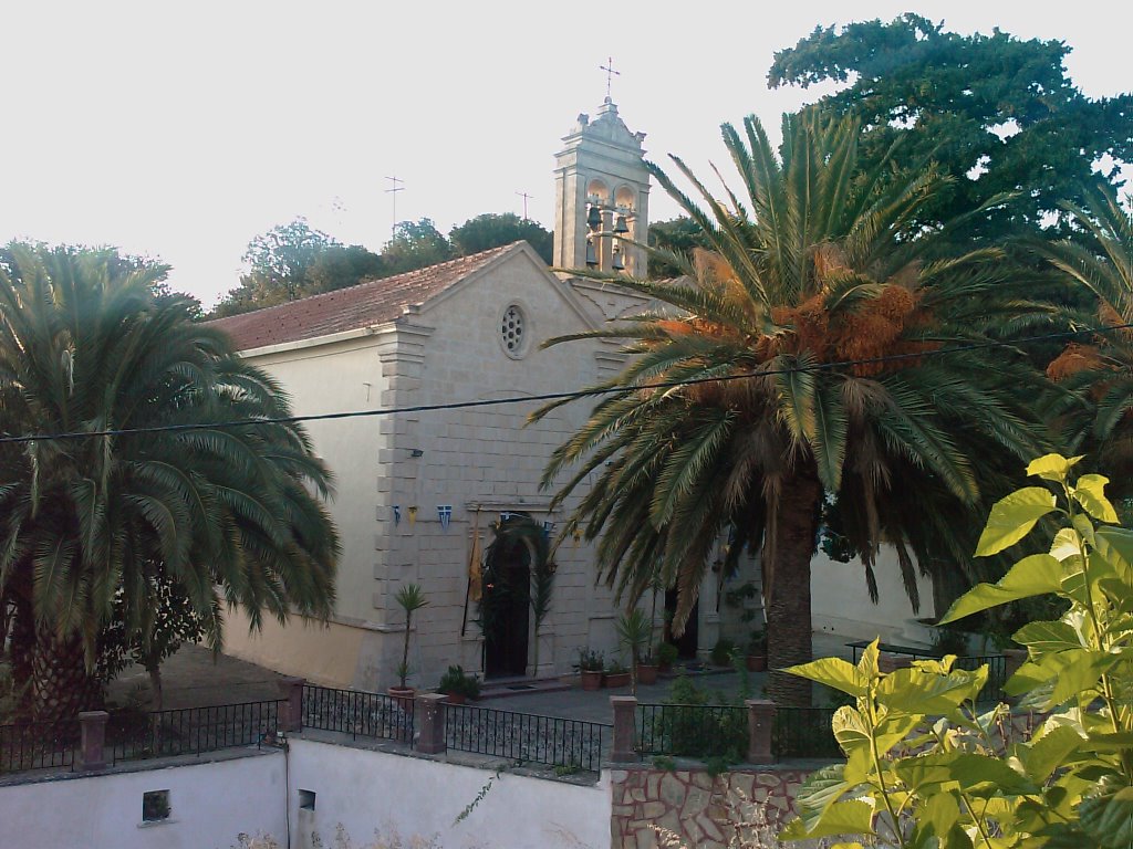
In the wider area of Nippos there are seventeen churches with remarkable icons and carved altarpieces. One of the oldest and most impressive is that of Panagia Perivolitsiani or Pervolitissa, around which many monks and priests have been buried. During the late Venetian rule, the School of the Friars was founded in this location, which later became an Orthodox monastery. The central church of the village is dedicated to the Holy Cross, while the old fountain of the village, which the locals call Rafioli and associate with the bishop Raphael, is quite well known.
Administratively, the village was referred to as Nippos of the Municipality of Fres in 1881 and 1900, the seat of the homonymous rural municipality in 1920 and an independent community in 1925. In 1940 the name of the village was changed to Nipos, while in 1997 it became part of the Municipality of Krionerida which became a Municipal Unit of the Municipality of Apokoronas in 2010.


Editing & editing of texts: Giorgos Limantzakis
FONES
Fones is located at an altitude of 136 meters in the south of the valley of Almiros, at the eastern end of the Municipal Unit of Krionerida. The village is built in a lowland location at the base of the Dafnokorfi hill (altitude 693 meters), which is opposite the southern end of the Vamos and Kefalas hills. It is not known where the name of the village comes from or when it was founded, but Troullinos mentions that in 1571 it was the target of a raid by the Ottoman pirate Uluç Ali, who also destroyed Alikampos. Fones was not mentioned in the Venetian censuses, but it was mentioned as Phoné in the Egyptian census of 1834, according to which it was inhabited by 18 Christian families.
The church of the village is dedicated to Agios Panteleimon, while a second one exists on the slope towards Dafnokorfi in the southeast of the village, dedicated to Agios Ioannis Rigologos (celebrated on 29 August). A lime production unit is located in Fones,and there is a quarry at the south of the village.
Administratively, Fones was part of the Municipality of Mathes in 1881, the Municipality of Georgioupoli in 1900, the rural municipality of Maza in 1920 and the community of Maza after 1925. In 1997 Fones became part of the Municipality of Krionerida, which became a Municipal Unit of the Municipality of Apokoronas in 2010.


Editing & editing of texts: Giorgos Limantzakis
CHABATHA
Chambatha is located at an altitude of 164 meters in the south of the Almiros valley, a short distance from Maza. Regarding the origin of the name, Spanakis states that it may be related to the word “hambasa”, which is used to describe a rocky and barren place.
It is not known exactly when the village was founded, but at its northwestern end there is a single-chamber church dedicated to Agios Georgios, which was built in the 14th century (during the second Byzantine period) and has several – worn, but impressive – frescoes, probably created by the well-known painter Ioannis Pagomenos. At the eastern end of the village, on the road that connects it to Maza and Fones, there is another church, dedicated to the Archangel Michael, celebrated on 8 November.
The village was mentioned by Barozzi in 1578 as Ghabatha, by Castrofilaca in 1583 as Maxa Filippu Ganbassa (along with the villages of Maza and Filippos) and by Basilicata in 1630 as Chabata. The village was also mentioned as Khábata in the Egyptian census of 1834, according to which it was inhabited by 6 Christian families.
Administratively, Chambatha was part of the Municipality of Mathes in 1881, the Municipality of Georgioupoli in 1900, the rural municipality of Maza in 1920 and the community of Maza after 1925. In 1997 Chambatha became part of the Municipality of Krionerida which became a Municipal Unit of the Municipality of Apokoronas in 2010.


Editing & editing of texts: Giorgos Limantzakis